Geolocate

Urawade topographic map

Click on the map to display elevation.

About this map

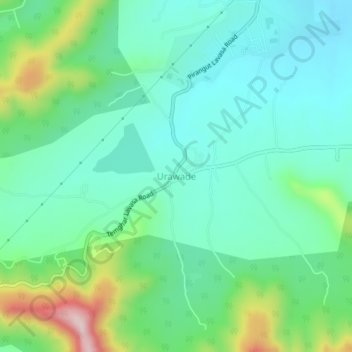
Name: Urawade topographic map, elevation, terrain.

Location: Urawade, Mulshi, Pune, Maharashtra, India (18.46270 73.64364 18.50270 73.68364)

Average elevation: 688 m

Minimum elevation: 585 m

Maximum elevation: 988 m

Other topographic maps

Click on a map to view its topography, its elevation and its terrain.

Aamby Valley

India > Maharashtra > Mulshi

Average elevation: 710 m

Gear up for your next adventure:

🧦Crew Hiking Socks - Comfortable socks for long-distance hikes
🛌Insulated Sleeping Pad - Critical thermal barrier between you and the cold ground
Backpacking Tent - Lightweight tent for long-distance hiking trips
🛶Waterproof Dry Bags - Keep electronics and clothes dry during river crossings
🧣Evaporative Cooling Towel - Beat the heat during intense summer climbs

As an Amazon Associate, this site earns from qualifying purchases at no extra cost to you.