Geolocate

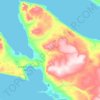
Young Island topographic map

Click on the map to display elevation.

About this map

Name: Young Island topographic map, elevation, terrain.

Location: Young Island, Qikiqtaaluk Region, Nunavut, Canada (74.30466 -98.85102 74.34701 -98.46644)

Average elevation: 2 m

Minimum elevation: -1 m

Maximum elevation: 55 m

Other topographic maps

Click on a map to view its topography, its elevation and its terrain.

Mount Asgard

Canada > Nunavut > Qikiqtaaluk Region

Average elevation: 1,201 m

Arctic Bay

Canada > Nunavut > Qikiqtaaluk Region

Arctic Bay experiences a tundra climate (Köppen: ET) like most northern Canadian territories at low elevations, with long, very cold winters and short, cool to cold summers. July is the only month with an average low temperature above freezing. Its climate does not differ from the more severe subarctic…

Average elevation: 160 m

Fellfoot Point

Canada > Nunavut > Qikiqtaaluk Region

Average elevation: 2 m

Horizon Hill

Canada > Nunavut > Qikiqtaaluk Region

Average elevation: 139 m

Bjorne Peninsula

Canada > Nunavut > Qikiqtaaluk Region

Average elevation: 155 m

Cape Rosamond

Canada > Nunavut > Qikiqtaaluk Region

Average elevation: 3 m

Gear up for your next adventure:

🥾Mountain Hiking Boots - High-traction boots for rocky terrain
🧣Merino Neck Gaiter - Protects against wind, sun, and cold at high altitudes
⛺Camping Groundsheet - Protect your tent from moisture and dirt
🥽Outdoor Goggles - Protective eyewear for outdoor activities
🚑Survival Whistle - Signal for help across long distances in mountains

As an Amazon Associate, this site earns from qualifying purchases at no extra cost to you.