Geolocate

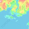
St. Paul's topographic map

Click on the map to display elevation.

About this map

Name: St. Paul's topographic map, elevation, terrain.

Location: St. Paul's, Newfoundland, Newfoundland and Labrador, A0K 4Y0, Canada (49.84173 -57.85591 49.88290 -57.76010)

Average elevation: 5 m

Minimum elevation: -1 m

Maximum elevation: 59 m

Other topographic maps

Click on a map to view its topography, its elevation and its terrain.

Botwood

Canada > Newfoundland and Labrador > Botwood

Average elevation: 17 m

LaScie

Canada > Newfoundland and Labrador

Average elevation: 98 m

Spot Pond

Canada > Newfoundland and Labrador

Average elevation: 118 m

The Peak

Canada > Newfoundland and Labrador

Average elevation: 67 m

Roundabout

Canada > Newfoundland and Labrador

Average elevation: 65 m

The Cabox

Canada > Newfoundland and Labrador

Average elevation: 698 m

White Horse

Canada > Newfoundland and Labrador

Average elevation: 99 m

Gear up for your next adventure:

🧣Merino Neck Gaiter - Protects against wind, sun, and cold at high altitudes
🥾Light Hiking Boots - Lightweight and comfortable boots for day hikes
🔭Compact Monocular - One-handed bird watching and trail spotting
🪑Ultralight Camping Stool - Compact seating for rest stops during long hikes
🧥Softshell Hiking Jacket - The perfect balance of wind protection and breathability

As an Amazon Associate, this site earns from qualifying purchases at no extra cost to you.