
Make a donation
Gear up for your next adventure:
As an Amazon Associate, this site earns from qualifying purchases at no extra cost to you.
Stavele topographic map
Click on the map to display elevation.
Make a donation
Gear up for your next adventure:
As an Amazon Associate, this site earns from qualifying purchases at no extra cost to you.
Stavele
Stavele ligt in het dal van de IJzer op een hoogte van 5 meter, terwijl de hoogte naar het zuiden geleidelijk toeneemt tot 11 meter. Het behoort tot Zandlemig Vlaanderen. Ten oosten van de dorpskom bevindt zich het Eversambos, vlak bij de samenvloeiing van de IJzer en de Poperingevaart.
Make a donation
Gear up for your next adventure:
As an Amazon Associate, this site earns from qualifying purchases at no extra cost to you.
About this map
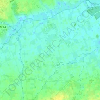
Name: Stavele topographic map, elevation, terrain.
Location: Stavele, Alveringem, Veurne, West-Vlaanderen, België (50.90663 2.64984 50.95140 2.71978)
Average elevation: 5 m
Minimum elevation: -3 m
Maximum elevation: 17 m
Make a donation
Gear up for your next adventure:
As an Amazon Associate, this site earns from qualifying purchases at no extra cost to you.