Geolocate

Zgierz County topographic map

Click on the map to display elevation.

About this map

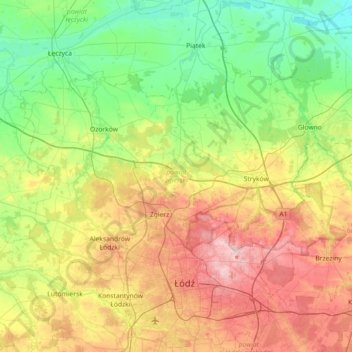
Name: Zgierz County topographic map, elevation, terrain.

Location: Zgierz County, Łódzkie Voivodship, Poland (51.77123 19.12041 52.03695 19.84003)

Average elevation: 156 m

Minimum elevation: 87 m

Maximum elevation: 281 m

Other topographic maps

Click on a map to view its topography, its elevation and its terrain.

Seligów

Poland > Łódzkie Voivodship > Łowicz County

Average elevation: 114 m

Gear up for your next adventure:

🧦Thermal Socks - Warm socks for winter hiking or camping
🔭Outdoor Binoculars - Lightweight binoculars for birdwatching and hiking
🧭GPS Handheld Device - Reliable GPS navigation for outdoor adventures
💡LED Headlamp - Hands-free illumination for night hiking and camping
🧤Insulated Winter Gloves - Heavy-duty protection for sub-zero Canadian adventures

As an Amazon Associate, this site earns from qualifying purchases at no extra cost to you.