Geolocate

Turbina topographic map

Click on the map to display elevation.

About this map
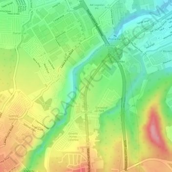
Name: Turbina topographic map, elevation, terrain.

Location: Turbina, Calamba, Laguna, Calabarzon, 4027, Philippines (14.18167 121.13308 14.19499 121.14283)

Average elevation: 81 m

Minimum elevation: 20 m

Maximum elevation: 152 m

Gear up for your next adventure:

🚲Handlebar Phone Mount - View topographic-map.com live while cycling
⛺Backpacking Tent - Lightweight tent for long-distance hiking trips
🔪Outdoor Multitool - Versatile tool for repairs and food prep in the wild
🧥Waterproof Jacket - Lightweight rain jackets for hiking and outdoor activities
🥾Approach Boots - Comfortable boots for hiking and climbing approaches

As an Amazon Associate, this site earns from qualifying purchases at no extra cost to you.