
Thank you for supporting this site ❤️
Make a donation
Make a donation
Gear up for your next adventure:
As an Amazon Associate, this site earns from qualifying purchases at no extra cost to you.
Servi topographic map
Click on the map to display elevation.
Thank you for supporting this site ❤️
Make a donation
Make a donation
Gear up for your next adventure:
As an Amazon Associate, this site earns from qualifying purchases at no extra cost to you.
About this map
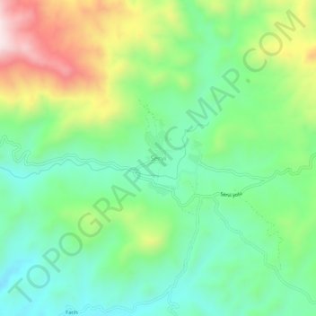
Name: Servi topographic map, elevation, terrain.
Location: Servi, Genç, Bingöl, Oost-Anatolië, Turkije (38.55224 40.29448 38.59224 40.33448)
Average elevation: 1,089 m
Minimum elevation: 907 m
Maximum elevation: 1,442 m
Thank you for supporting this site ❤️
Make a donation
Make a donation
Gear up for your next adventure:
As an Amazon Associate, this site earns from qualifying purchases at no extra cost to you.