Geolocate

Kichwa topographic map

Click on the map to display elevation.

About this map

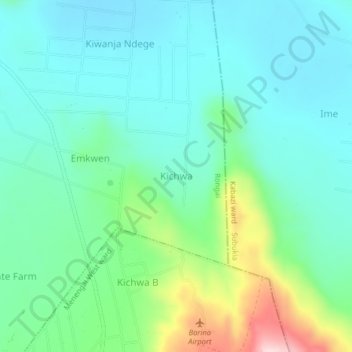
Name: Kichwa topographic map, elevation, terrain.

Location: Kichwa, Soin ward, Rongai, Nakuru, Kenya (-0.13936 35.99481 -0.09936 36.03481)

Average elevation: 1,773 m

Minimum elevation: 1,704 m

Maximum elevation: 1,991 m

Gear up for your next adventure:

Tent Footprint - Protect tent floor and increase durability
📷Outdoor Action Camera - Capture high-elevation views and rugged adventures
💡Solar Camping Lamp - Eco-friendly lighting for campsites
🔦LED Headtorch - Bright and durable light for night activities
🧥Fleece Jacket - Warm and lightweight jacket for layering

As an Amazon Associate, this site earns from qualifying purchases at no extra cost to you.