Geolocate

Bhoje topographic map

Click on the map to display elevation.

About this map

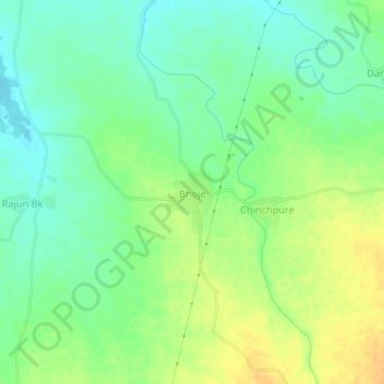
Name: Bhoje topographic map, elevation, terrain.

Location: Bhoje, Pachora, Jalgaon, Maharashtra, 424203, India (20.58983 75.44170 20.62983 75.48170)

Average elevation: 288 m

Minimum elevation: 274 m

Maximum elevation: 304 m

Gear up for your next adventure:

🧣Merino Neck Gaiter - Protects against wind, sun, and cold at high altitudes
🔨Vehicle Emergency Tool - Safety tool for remote road trips to trailheads
🥾Mountain Hiking Boots - High-traction boots for rocky terrain
💧Filtered Water Bottle - Safe drinking water on the go
🛰️Satellite Messenger - Emergency communication for areas with no cell service

As an Amazon Associate, this site earns from qualifying purchases at no extra cost to you.