Geolocate

Amlipali topographic map

Click on the map to display elevation.

About this map

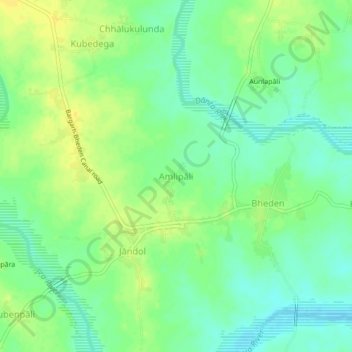
Name: Amlipali topographic map, elevation, terrain.

Location: Amlipali, Bheden, Bargarh District, Odisha, 768104, India (21.18064 83.72045 21.22064 83.76045)

Average elevation: 144 m

Minimum elevation: 133 m

Maximum elevation: 156 m

Gear up for your next adventure:

🪑Ultralight Camping Stool - Compact seating for rest stops during long hikes
🕶️Polarized Sunglasses - Protect your eyes with durable polarized lenses
🧥Softshell Jacket - Windproof and breathable jacket for hiking
🧥Thermal Fleece Jacket - Versatile insulation for changing mountain temperatures
🧥Thermal Layer - Insulating layer for cold outdoor conditions

As an Amazon Associate, this site earns from qualifying purchases at no extra cost to you.