Geolocate

Heidelberg topographic map

Click on the map to display elevation.

About this map

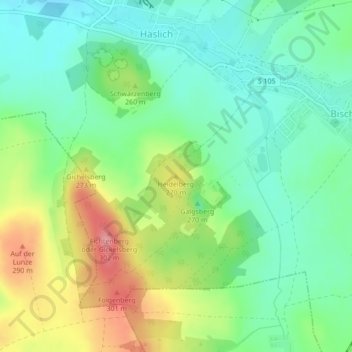
Name: Heidelberg topographic map, elevation, terrain.

Location: Heidelberg, Haselbachtal, Bautzen, Sachsen, 01896, Deutschland (51.23409 14.01723 51.23419 14.01733)

Average elevation: 243 m

Minimum elevation: 206 m

Maximum elevation: 308 m

Gear up for your next adventure:

🧰Survival Kit - Essential gear for emergencies in the wilderness
🥾Hiking Gaiters - Protect legs and shoes from mud, snow, and debris
🧰Multitool Knife - Compact and versatile tool for outdoor use
🥾Hiking Shoes - Durable and comfortable shoes for trail hiking
🧦Thermal Socks - Warm socks for winter hiking or camping

As an Amazon Associate, this site earns from qualifying purchases at no extra cost to you.