Geolocate

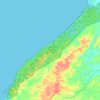
Bau topographic map

Click on the map to display elevation.

About this map

Name: Bau topographic map, elevation, terrain.

Location: Bau, Kuching Division, Sarawak, 94000, Malaysia (1.19461 109.92909 1.57265 110.28172)

Average elevation: 101 m

Minimum elevation: -5 m

Maximum elevation: 1,129 m

Other topographic maps

Click on a map to view its topography, its elevation and its terrain.
Kampung Pemukat

Malaysia > Sarawak > Limbang

Average elevation: 16 m

Kampong Sungai Baong

Malaysia > Sarawak > Miri

Average elevation: 9 m

Bau

Malaysia > Sarawak > Bau

Average elevation: 49 m

Kampung Pasir Pandak

Malaysia > Sarawak > Kuching

Average elevation: 16 m

Bakun Dam

Malaysia > Sarawak

Average elevation: 195 m

Bekenu

Malaysia > Sarawak > Subis

Average elevation: 10 m

Bako Bazaar

Malaysia > Sarawak > Kuching

Average elevation: 8 m

Kampung Santubong

Malaysia > Sarawak

Average elevation: 70 m

Batu Niah

Malaysia > Sarawak > Subis

Average elevation: 43 m

Similajau National Park

Malaysia > Sarawak > Bintulu

Average elevation: 29 m

Kampung Tambey

Malaysia > Sarawak

Average elevation: 2 m

Gear up for your next adventure:

🦯Trekking Poles - Reduced impact on joints for steep topographic climbs
❄️Traction Ice Cleats - Slip-on spikes for icy trails and winter hiking
🛁Quick-Dry Microfiber Towel - Space-saving towel that dries rapidly on the move
🌡️Emergency Mylar Blankets - Compact thermal protection for unexpected nights outdoors
🥾Light Hiking Boots - Lightweight and comfortable boots for day hikes

As an Amazon Associate, this site earns from qualifying purchases at no extra cost to you.