Geolocate

Kaptembwa topographic map

Click on the map to display elevation.

About this map

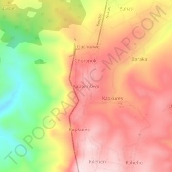
Name: Kaptembwa topographic map, elevation, terrain.

Location: Kaptembwa, Kuresoi North, Nakuru, Rift Valley, Kenya (-0.23523 35.64003 -0.19523 35.68003)

Average elevation: 2,588 m

Minimum elevation: 2,331 m

Maximum elevation: 2,758 m

Gear up for your next adventure:

🧥Waterproof Hiking Jacket - Protect yourself from rain and wind while hiking
🛏️Camping Sleeping Mat - Comfortable mats for sleeping outdoors
🏕️Camping Hammock - Integrated protection for sleeping between trees
🥾Waterproof Trail Shoes - Shoes designed to handle wet terrain
❄️Traction Ice Cleats - Slip-on spikes for icy trails and winter hiking

As an Amazon Associate, this site earns from qualifying purchases at no extra cost to you.