Geolocate

Cariño topographic map

Click on the map to display elevation.

About this map

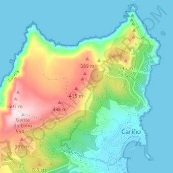
Name: Cariño topographic map, elevation, terrain.

Location: Cariño, Ortegal, A Coruña, Galicia, 15360, Spain (43.73147 -7.91866 43.77374 -7.85784)

Average elevation: 150 m

Minimum elevation: -1 m

Maximum elevation: 548 m

Other topographic maps

Click on a map to view its topography, its elevation and its terrain.

A Felgueira

Spain > Galicia > Ortegal > Cariño

Average elevation: 111 m

Gear up for your next adventure:

🧴First Aid Kit - Essential first aid supplies for outdoor emergencies
🔪Outdoor Multitool - Versatile tool for repairs and food prep in the wild
🧤Rechargeable Heated Gloves - Extreme warmth for Canadian winter expeditions
🛶Waterproof Dry Bags - Keep electronics and clothes dry during river crossings
🧭Orienteering Kit - Tools for map reading and navigation in the wild

As an Amazon Associate, this site earns from qualifying purchases at no extra cost to you.