Geolocate

Blue Knob topographic map

Click on the map to display elevation.

About this map

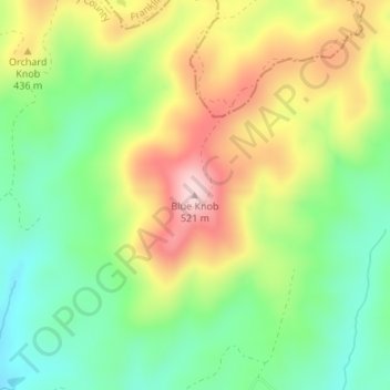
Name: Blue Knob topographic map, elevation, terrain.

Location: Blue Knob, Henry County, Virginia, United States (36.78287 -79.76342 36.78297 -79.76332)

Average elevation: 363 m

Minimum elevation: 253 m

Maximum elevation: 510 m

Gear up for your next adventure:

💡Compact LED Flashlight - Powerful and portable flashlight for outdoor use
🧢Hiking Sun Hat - Wide-brimmed protection for exposed mountain ridges
🥾Lightweight Hiking Shoes - Comfortable shoes for day hikes
🔭Compact Binoculars - Lightweight optics for scouting trails and wildlife
🛏️Camping Sleeping Mat - Comfortable mats for sleeping outdoors

As an Amazon Associate, this site earns from qualifying purchases at no extra cost to you.