Geolocate

Pinar topographic map

Click on the map to display elevation.

About this map

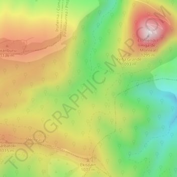
Name: Pinar topographic map, elevation, terrain.

Location: Pinar, Monreal, Prepirineo, Navarra, España (42.67777 -1.55356 42.69777 -1.53356)

Average elevation: 978 m

Minimum elevation: 698 m

Maximum elevation: 1,277 m

Gear up for your next adventure:

🧦Thermal Socks - Warm socks for winter hiking or camping
🧥Softshell Hiking Jacket - The perfect balance of wind protection and breathability
💡Solar Camping Lamp - Eco-friendly lighting for campsites
🏃Hydration Running Vest - Carry water and maps close to your body for speed
🚑Survival Whistle - Signal for help across long distances in mountains

As an Amazon Associate, this site earns from qualifying purchases at no extra cost to you.