
Thank you for supporting this site ❤️
Make a donation
Make a donation
Gear up for your next adventure:
As an Amazon Associate, this site earns from qualifying purchases at no extra cost to you.
Wald topographic map
Click on the map to display elevation.
Thank you for supporting this site ❤️
Make a donation
Make a donation
Gear up for your next adventure:
As an Amazon Associate, this site earns from qualifying purchases at no extra cost to you.
About this map
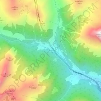
Name: Wald topographic map, elevation, terrain.
Location: Wald, Zederhaus, Bezirk Tamsweg, Salzburg, 5584, Österreich (47.16129 13.41738 47.20129 13.45738)
Average elevation: 1,732 m
Minimum elevation: 1,244 m
Maximum elevation: 2,474 m
Thank you for supporting this site ❤️
Make a donation
Make a donation
Gear up for your next adventure:
As an Amazon Associate, this site earns from qualifying purchases at no extra cost to you.