Geolocate

Wiesenburg topographic map

Click on the map to display elevation.

About this map

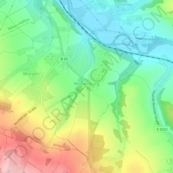
Name: Wiesenburg topographic map, elevation, terrain.

Location: Wiesenburg, Wildenfels, Zwickau, Saxony, Germany (50.63418 12.55429 50.65569 12.57852)

Average elevation: 362 m

Minimum elevation: 287 m

Maximum elevation: 485 m

Gear up for your next adventure:

🥾Hiking Boots - Sturdy boots providing ankle support and traction on rugged trails
🥾Mountain Hiking Boots - High-traction boots for rocky terrain
🧥Softshell Hiking Jacket - The perfect balance of wind protection and breathability
🥾Trekking Boots - Durable boots for long-distance trekking
🥾Lightweight Hiking Boots - Boots for comfort and mobility on long hikes

As an Amazon Associate, this site earns from qualifying purchases at no extra cost to you.