Geolocate

Hatherleigh topographic map

Click on the map to display elevation.

About this map

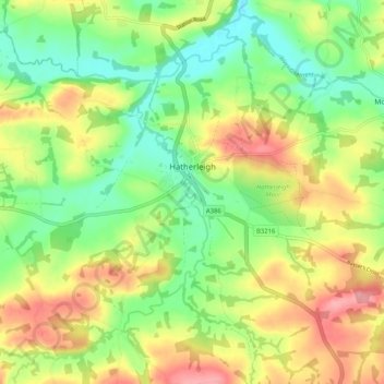
Name: Hatherleigh topographic map, elevation, terrain.

Location: Hatherleigh, West Devon, Devon, England, United Kingdom (50.78531 -4.11393 50.84619 -4.01099)

Average elevation: 96 m

Minimum elevation: 50 m

Maximum elevation: 155 m

Gear up for your next adventure:

👟Trail Running Shoes - Agile footwear for fast-paced topographic exploration
🧥Thermal Layer - Insulating layer for cold outdoor conditions
🧊Insulated Water Bottle - Keeps drinks cold in summer and prevents freezing in winter
🧭GPS Handheld Device - Reliable GPS navigation for outdoor adventures
👟Sport Hiking Sandals - Breathable footwear for water crossings and camp rest

As an Amazon Associate, this site earns from qualifying purchases at no extra cost to you.