Geolocate

Zarumilla topographic map

Click on the map to display elevation.

About this map

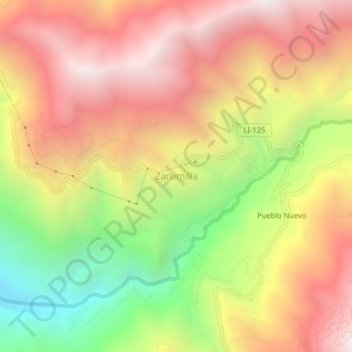
Name: Zarumilla topographic map, elevation, terrain.

Location: Zarumilla, Patáz, Pataz, La Libertad, Perú (-7.78205 -77.61754 -7.74205 -77.57754)

Average elevation: 2,636 m

Minimum elevation: 1,687 m

Maximum elevation: 3,395 m

Other topographic maps

Click on a map to view its topography, its elevation and its terrain.

Patáz

Perú > La Libertad > Patáz

Average elevation: 2,988 m

Gear up for your next adventure:

📷Outdoor Action Camera - Capture high-elevation views and rugged adventures
🧢Outdoor Cap - Protective cap for sun and rain during hikes
Camping Groundsheet - Protect your tent from moisture and dirt
🔥Camping Stove - Portable stoves to cook outdoors with ease
🏃Hydration Running Vest - Carry water and maps close to your body for speed

As an Amazon Associate, this site earns from qualifying purchases at no extra cost to you.