
Thank you for supporting this site ❤️
Make a donation
Make a donation
Gear up for your next adventure:
As an Amazon Associate, this site earns from qualifying purchases at no extra cost to you.
Hochfilzen topographic map
Click on the map to display elevation.
Thank you for supporting this site ❤️
Make a donation
Make a donation
Gear up for your next adventure:
As an Amazon Associate, this site earns from qualifying purchases at no extra cost to you.
About this map
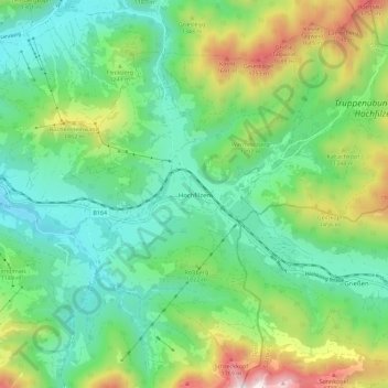
Name: Hochfilzen topographic map, elevation, terrain.
Location: Hochfilzen, Bezirk Kitzbühel, Tyrol, 6395, Austria (47.43210 12.58849 47.50823 12.69959)
Average elevation: 1,152 m
Minimum elevation: 799 m
Maximum elevation: 1,990 m
Thank you for supporting this site ❤️
Make a donation
Make a donation
Gear up for your next adventure:
As an Amazon Associate, this site earns from qualifying purchases at no extra cost to you.