Geolocate

Gunung Lawu topographic map

Click on the map to display elevation.

About this map

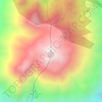
Name: Gunung Lawu topographic map, elevation, terrain.

Location: Gunung Lawu, Karanganyar, Central Java, Java, Indonesia (-7.62743 111.19427 -7.62733 111.19437)

Average elevation: 2,881 m

Minimum elevation: 2,346 m

Maximum elevation: 3,238 m

Gear up for your next adventure:

🧴Bear Spray Holster - Quick-access carry for essential Canadian wilderness safety
🔭Outdoor Binoculars - Lightweight binoculars for birdwatching and hiking
🩹Compact First Aid Kit - Pre-packed essentials for common trail injuries
🧤Thermal Hiking Gloves - Grip-enhanced gloves for cold-weather altitude trekking
👟Leg Gaiters - Keep debris, mud, and snow out of your boots

As an Amazon Associate, this site earns from qualifying purchases at no extra cost to you.