Geolocate

Staffalo topographic map

Click on the map to display elevation.

About this map

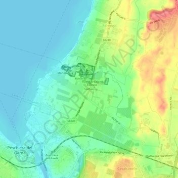
Name: Staffalo topographic map, elevation, terrain.

Location: Staffalo, Castelnuovo del Garda, Verona, Veneto, 37014, Italy (45.43271 10.69421 45.47271 10.73421)

Average elevation: 86 m

Minimum elevation: 62 m

Maximum elevation: 134 m

Gear up for your next adventure:

🦌Outdoor Trail Camera - Monitor wildlife activity near your favorite spots
🛌Down Sleeping Bag - Superior warmth-to-weight ratio for cold nights
🧥Ultralight Puffy Jacket - Maximum warmth that packs down to the size of an orange
🥘Camping Cookware Set - Compact nesting pots and pans for trail cooking
🛰️Satellite Messenger - Emergency communication for areas with no cell service

As an Amazon Associate, this site earns from qualifying purchases at no extra cost to you.