Geolocate

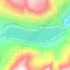
Nye topographic map

Click on the map to display elevation.

About this map

Name: Nye topographic map, elevation, terrain.

Location: Nye, Stillwater County, Montana, United States (45.41502 -109.82365 45.45502 -109.78365)

Average elevation: 1,535 m

Minimum elevation: 1,441 m

Maximum elevation: 1,865 m

Other topographic maps

Click on a map to view its topography, its elevation and its terrain.

Columbus

United States > Montana > Stillwater County

Average elevation: 1,107 m

Mystic Lake

United States > Montana > Stillwater County

Average elevation: 2,641 m

Princess Lake

United States > Montana > Stillwater County

Average elevation: 3,010 m

Park City

United States > Montana > Stillwater County > Park City

Average elevation: 1,049 m

Gear up for your next adventure:

🌬️Windproof Camp Stove - Efficient cooking even on exposed mountain peaks
🎒Fully Waterproof Backpack - Total protection for photography gear and electronics
⛺Lightweight Backpacking Tent - Compact tent for efficient hiking trips
⛺Tent Footprint - Protect tent floor and increase durability
🧥Waterproof Hiking Jacket - Protect yourself from rain and wind while hiking

As an Amazon Associate, this site earns from qualifying purchases at no extra cost to you.