Geolocate

Brunswick topographic map

Click on the map to display elevation.

About this map

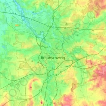
Name: Brunswick topographic map, elevation, terrain.

Location: Brunswick, Lower Saxony, Germany (52.18679 10.41245 52.35738 10.64339)

Average elevation: 83 m

Minimum elevation: 59 m

Maximum elevation: 128 m

Gear up for your next adventure:

🔦UV Flashlight - Detect minerals or specific insects in the dark
🥤Collapsible Travel Cup - Saves space and weight in your mess kit
🥾Waterproof Hiking Boots - Boots keeping your feet dry in wet conditions
🧥Softshell Hiking Jacket - The perfect balance of wind protection and breathability
🗺️Topographic Maps - Detailed maps to explore trails, mountains, and wilderness areas

As an Amazon Associate, this site earns from qualifying purchases at no extra cost to you.