Geolocate

Sayung topographic map

Click on the map to display elevation.

About this map

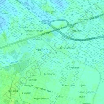
Name: Sayung topographic map, elevation, terrain.

Location: Sayung, Demak, Central Java, Java, 59563, Indonesia (-6.96828 110.49326 -6.92828 110.53326)

Average elevation: 4 m

Minimum elevation: 0 m

Maximum elevation: 9 m

Other topographic maps

Click on a map to view its topography, its elevation and its terrain.

Mijen

Indonesia > Central Java > Demak

Average elevation: 5 m

Karanganyar

Indonesia > Central Java > Demak

Average elevation: 7 m

Kali Tuntang

Indonesia > Central Java > Demak > Bonangrejo

Average elevation: 4 m

Bonang

Indonesia > Central Java > Demak

Average elevation: 3 m

Kali Tulung

Indonesia > Central Java > Demak > Gebangarum

Average elevation: 3 m

Gear up for your next adventure:

Camping Groundsheet - Protect your tent from moisture and dirt
🧴Bear Spray Holster - Quick-access carry for essential Canadian wilderness safety
💧Hydration Bladder - Hands-free hydration solution for long treks
🧥Ultralight Puffy Jacket - Maximum warmth that packs down to the size of an orange
🔋Solar Power Bank - Keep your GPS and devices charged during long outdoor trips

As an Amazon Associate, this site earns from qualifying purchases at no extra cost to you.