Geolocate

Salanpur topographic map

Click on the map to display elevation.

About this map

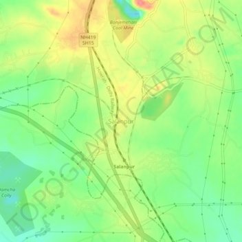
Name: Salanpur topographic map, elevation, terrain.

Location: Salanpur, Paschim Bardhaman, West Bengal, 713369, India (23.74797 86.85473 23.78797 86.89473)

Average elevation: 148 m

Minimum elevation: 114 m

Maximum elevation: 189 m

Gear up for your next adventure:

🥾Approach Boots - Comfortable boots for hiking and climbing approaches
🦶Anti-Blister Balm - Prevents friction and hotspots during long ascents
🎒Hiking Daypack - Lightweight and durable backpacks for day trips and excursions
🧢Sun Protection Cap - Breathable cap to protect from sun exposure
👟Sport Hiking Sandals - Breathable footwear for water crossings and camp rest

As an Amazon Associate, this site earns from qualifying purchases at no extra cost to you.