
Thank you for supporting this site ❤️
Make a donation
Make a donation
Gear up for your next adventure:
As an Amazon Associate, this site earns from qualifying purchases at no extra cost to you.
Tracchi topographic map
Click on the map to display elevation.
Thank you for supporting this site ❤️
Make a donation
Make a donation
Gear up for your next adventure:
As an Amazon Associate, this site earns from qualifying purchases at no extra cost to you.
About this map
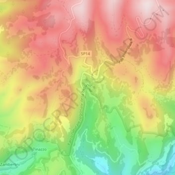
Name: Tracchi topographic map, elevation, terrain.
Location: Tracchi, Bosco Chiesanuova, Verona, Veneto, 37021, Italia (45.65698 11.04430 45.67698 11.06430)
Average elevation: 1,412 m
Minimum elevation: 1,148 m
Maximum elevation: 1,611 m
Thank you for supporting this site ❤️
Make a donation
Make a donation
Gear up for your next adventure:
As an Amazon Associate, this site earns from qualifying purchases at no extra cost to you.