
Thank you for supporting this site ❤️
Make a donation
Make a donation
Gear up for your next adventure:
As an Amazon Associate, this site earns from qualifying purchases at no extra cost to you.
Seema topographic map
Click on the map to display elevation.
Thank you for supporting this site ❤️
Make a donation
Make a donation
Gear up for your next adventure:
As an Amazon Associate, this site earns from qualifying purchases at no extra cost to you.
About this map
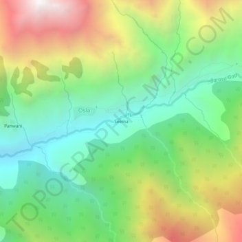
Name: Seema topographic map, elevation, terrain.
Location: Seema, Osla, Mori, Uttarkashi, Uttarakhand, India (31.09703 78.32994 31.13703 78.36994)
Average elevation: 3,175 m
Minimum elevation: 2,448 m
Maximum elevation: 4,348 m
Thank you for supporting this site ❤️
Make a donation
Make a donation
Gear up for your next adventure:
As an Amazon Associate, this site earns from qualifying purchases at no extra cost to you.