Geolocate

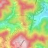
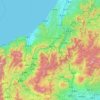
Hatsukaichi topographic map

Click on the map to display elevation.

About this map

Name: Hatsukaichi topographic map, elevation, terrain.

Location: Hatsukaichi, Hiroshima Prefecture, Japan (34.21566 132.03645 34.58315 132.36686)

Average elevation: 293 m

Minimum elevation: -3 m

Maximum elevation: 1,313 m

Other topographic maps

Click on a map to view its topography, its elevation and its terrain.
Osaka Prefecture

Japan

Average elevation: 188 m

300M

Japan > Nagasaki

Average elevation: 220 m

Akaishi Mountains

Japan > Oshika

Average elevation: 2,591 m

Iwo to

Japan > Tokyo > Ogasawara

Average elevation: 0 m

Takeda Castle

Japan > Asago

Average elevation: 174 m

葭町

Japan > Matsumoto

Average elevation: 616 m

Nishikigaoka-chuo Park

Japan > Sendai

Average elevation: 197 m

Nakauonuma County

Japan

Average elevation: 605 m

Mount Yatsugatake viewpoint

Japan > Suwa County > Fujimi

Average elevation: 1,742 m

Gear up for your next adventure:

🐕Hiking Dog Pack - Let your canine companion carry their own water and food
🦶Anti-Blister Balm - Prevents friction and hotspots during long ascents
🚲Heavy Duty Bike Lock - Secure your bike at the trailhead or during stops
🥾Hiking Shorts - Breathable shorts suitable for summer hikes
🥾Mountain Hiking Boots - High-traction boots for rocky terrain

As an Amazon Associate, this site earns from qualifying purchases at no extra cost to you.