
Make a donation
Gear up for your next adventure:
As an Amazon Associate, this site earns from qualifying purchases at no extra cost to you.
Stabroek topographic map
Click on the map to display elevation.
Make a donation
Gear up for your next adventure:
As an Amazon Associate, this site earns from qualifying purchases at no extra cost to you.
Stabroek
Ten westen en ten zuiden van Stabroek strekt het Antwerpse havengebied zich uit. Het grondgebied van Stabroek bestaat verder vooral uit Scheldepolders met een hoogte van 2-7 meter. Naar het noorden toe vindt men ook pleistoceen bos- en heidegebied. Midden in het Antwerpse havengebied vindt men het natuurgebied De Kuifeend.
Make a donation
Gear up for your next adventure:
As an Amazon Associate, this site earns from qualifying purchases at no extra cost to you.
About this map
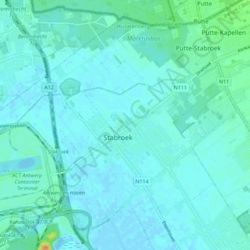
Name: Stabroek topographic map, elevation, terrain.
Location: Stabroek, Antwerpen, Vlaanderen, 2940, België (51.31350 4.32617 51.35669 4.40605)
Average elevation: 5 m
Minimum elevation: -4 m
Maximum elevation: 38 m
Make a donation
Gear up for your next adventure:
As an Amazon Associate, this site earns from qualifying purchases at no extra cost to you.