Geolocate

Luhdorf topographic map

Click on the map to display elevation.

About this map

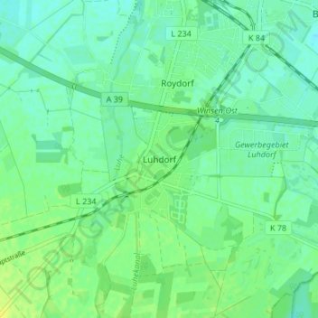
Name: Luhdorf topographic map, elevation, terrain.

Location: Luhdorf, Winsen (Luhe), Harburg, Lower Saxony, 21423, Germany (53.31222 10.18219 53.35222 10.22219)

Average elevation: 10 m

Minimum elevation: 3 m

Maximum elevation: 19 m

Gear up for your next adventure:

🛌Insulated Sleeping Pad - Critical thermal barrier between you and the cold ground
🚑Survival Whistle - Signal for help across long distances in mountains
🏃Hydration Running Vest - Carry water and maps close to your body for speed
Bushcraft Tarp - Versatile emergency shelter or gear protection
Backpacking Tent - Lightweight tent for long-distance hiking trips

As an Amazon Associate, this site earns from qualifying purchases at no extra cost to you.