Geolocate

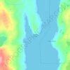
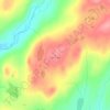
Dolland Pond topographic map

Click on the map to display elevation.

About this map

Name: Dolland Pond topographic map, elevation, terrain.

Location: Dolland Pond, Newfoundland, Newfoundland and Labrador, Canada (47.98265 -56.57292 48.03676 -56.44933)

Average elevation: 273 m

Minimum elevation: 248 m

Maximum elevation: 329 m

Other topographic maps

Click on a map to view its topography, its elevation and its terrain.
Labrador

Canada > Newfoundland and Labrador

Average elevation: 674 m

Englee

Canada > Newfoundland and Labrador > Englee

Average elevation: 34 m

Mount Caubvick

Canada > Newfoundland and Labrador

Average elevation: 1,272 m

Bridgeport

Canada > Newfoundland and Labrador

Average elevation: 22 m

Monroe

Canada > Newfoundland and Labrador

Average elevation: 41 m

Smokey

Canada > Newfoundland and Labrador > Smokey

Average elevation: 14 m

Tims Hill

Canada > Newfoundland and Labrador

Average elevation: 126 m

Gear up for your next adventure:

🔭Outdoor Binoculars - Lightweight binoculars for birdwatching and hiking
🧥Packable Rain Jacket - Breathable waterproof layer for unpredictable weather
🧢Hiking Sun Hat - Wide-brimmed protection for exposed mountain ridges
📷Outdoor Action Camera - Capture high-elevation views and rugged adventures
🚲Heavy Duty Bike Lock - Secure your bike at the trailhead or during stops

As an Amazon Associate, this site earns from qualifying purchases at no extra cost to you.