
Malinao topographic map
Click on the map to display elevation.
Malinao
Malinao occupies a narrow stretch of plains hemmed in by Lagonoy Gulf in the east and Mount Malinao on the west. The area is dominated by the mountain ranges of Malinao, with a peak altitude of 1,584 metres (5,197 ft) above sea level. It is 30 kilometres (19 mi) from Legazpi City and 557 kilometres (346 mi) southeast of Manila.
About this map
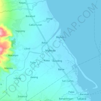
Name: Malinao topographic map, elevation, terrain.
Location: Malinao, Albay, Bicol Region, 4514, Philippines (13.35746 123.66498 13.43746 123.74498)
Average elevation: 17 m
Minimum elevation: -1 m
Maximum elevation: 217 m
Other topographic maps
Click on a map to view its topography, its elevation and its terrain.