
Thank you for supporting this site ❤️
Make a donation
Make a donation
Gear up for your next adventure:
As an Amazon Associate, this site earns from qualifying purchases at no extra cost to you.
Yeşilalan topographic map
Click on the map to display elevation.
Thank you for supporting this site ❤️
Make a donation
Make a donation
Gear up for your next adventure:
As an Amazon Associate, this site earns from qualifying purchases at no extra cost to you.
About this map
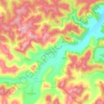
Name: Yeşilalan topographic map, elevation, terrain.
Location: Yeşilalan, Savur, Mardin, Southeastern Anatolia Region, Turkey (37.44334 40.76712 37.48334 40.80712)
Average elevation: 1,023 m
Minimum elevation: 926 m
Maximum elevation: 1,097 m
Thank you for supporting this site ❤️
Make a donation
Make a donation
Gear up for your next adventure:
As an Amazon Associate, this site earns from qualifying purchases at no extra cost to you.