
Council Bluffs topographic map
Click on the map to display elevation.
Council Bluffs
Council Bluffs covers a unique topographic region originally composed of prairie and savanna in the Loess Hills with extensive wetlands and deciduous forest along the Missouri River. Excellent vistas can be had from KOIL Point at Fairmont Park, the Lincoln Monument, Kirn Park, and the Lewis and Clark Monument. Lake Manawa State Park is located at the southern edge of the city.
About this map
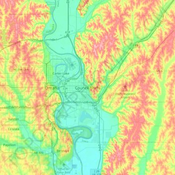
Name: Council Bluffs topographic map, elevation, terrain.
Average elevation: 338 m
Minimum elevation: 289 m
Maximum elevation: 412 m