
Thank you for supporting this site ❤️
Make a donation
Make a donation
Gear up for your next adventure:
As an Amazon Associate, this site earns from qualifying purchases at no extra cost to you.
Rubite topographic map
Click on the map to display elevation.
Thank you for supporting this site ❤️
Make a donation
Make a donation
Gear up for your next adventure:
As an Amazon Associate, this site earns from qualifying purchases at no extra cost to you.
About this map
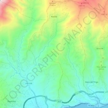
Name: Rubite topographic map, elevation, terrain.
Average elevation: 533 m
Minimum elevation: -2 m
Maximum elevation: 1,842 m
Thank you for supporting this site ❤️
Make a donation
Make a donation
Gear up for your next adventure:
As an Amazon Associate, this site earns from qualifying purchases at no extra cost to you.
Other topographic maps
Click on a map to view its topography, its elevation and its terrain.
Caleta-La Guardia
Spanien > Andalusien > Comarca de la Costa Granadina > Salobreña
Average elevation: 78 m
La Gorgoracha
Spanien > Andalusien > Comarca de la Costa Granadina > Vélez de Benaudalla
Average elevation: 356 m