
Thank you for supporting this site ❤️
Make a donation
Make a donation
Gear up for your next adventure:
As an Amazon Associate, this site earns from qualifying purchases at no extra cost to you.
Cajas topographic map
Click on the map to display elevation.
Thank you for supporting this site ❤️
Make a donation
Make a donation
Gear up for your next adventure:
As an Amazon Associate, this site earns from qualifying purchases at no extra cost to you.
About this map
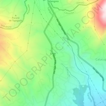
Name: Cajas topographic map, elevation, terrain.
Location: Cajas, Tupigachi, Pedro Moncayo Canton, Pichincha, Ecuador (0.09898 -78.20585 0.13898 -78.16585)
Average elevation: 3,119 m
Minimum elevation: 2,818 m
Maximum elevation: 3,676 m
Thank you for supporting this site ❤️
Make a donation
Make a donation
Gear up for your next adventure:
As an Amazon Associate, this site earns from qualifying purchases at no extra cost to you.