Wuhan topographic map
Interactive map
Click on the map to display elevation.
About this map
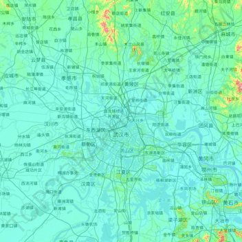
Name: Wuhan topographic map, elevation, terrain.
Location: Wuhan, Hubei, China (29.97196 113.69665 31.36224 115.07693)
Average elevation: 48 m
Minimum elevation: 8 m
Maximum elevation: 976 m
Other topographic maps
Click on a map to view its topography, its elevation and its terrain.
Yiling District
Yiling District, Yichang, Hubei, China
Average elevation: 596 m
Yunchi Subdistrict
China > Hubei > Xiaoting District
Yunchi Subdistrict, Xiaoting District, Yichang, Hubei, 443007, China
Average elevation: 107 m
Jianshi
China > Hubei > Jianshi County > Jianshi
Jianshi, Jianshi County, Enshi Tujia and Miao Autonomous Prefecture, Hubei, China
Average elevation: 1,018 m
Three Gorges Dam
Three Gorges Dam, Yiling District, Yichang, Hubei, China
Average elevation: 96 m