Geolocate

Myro topographic map

Click on the map to display elevation.

About this map

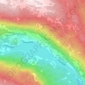
Name: Myro topographic map, elevation, terrain.

Location: Myro, Hol, Buskerud, 3576, Norway (60.59434 8.29322 60.63434 8.33322)

Average elevation: 805 m

Minimum elevation: 505 m

Maximum elevation: 1,119 m

Gear up for your next adventure:

🧦Hiking Socks - Moisture-wicking and comfortable socks for long hikes
🧭GPS Outdoor Watch - Smart watch for navigation and fitness tracking in nature
🧢Outdoor Cap - Protective cap for sun and rain during hikes
🚲Handlebar Phone Mount - View topographic-map.com live while cycling
🧴Waterproofing Spray - Restore the DWR coating on jackets and tents

As an Amazon Associate, this site earns from qualifying purchases at no extra cost to you.