
Make a donation
Gear up for your next adventure:
As an Amazon Associate, this site earns from qualifying purchases at no extra cost to you.
Monte Subasio topographic map
Click on the map to display elevation.
Make a donation
Gear up for your next adventure:
As an Amazon Associate, this site earns from qualifying purchases at no extra cost to you.
Monte Subasio
Sul versante assisano, a 791 metri d'altitudine è sito l'eremo delle Carceri, monastero di grotte dove san Francesco era solito rifugiarsi in meditazione con i suoi compagni. Alle pendici del monte, in località Viole è sita la sede dell'emittente Radio Subasio.
Make a donation
Gear up for your next adventure:
As an Amazon Associate, this site earns from qualifying purchases at no extra cost to you.
About this map
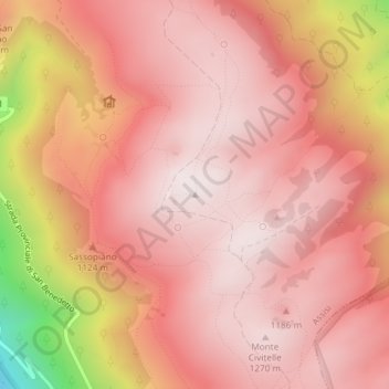
Name: Monte Subasio topographic map, elevation, terrain.
Location: Monte Subasio, Assisi, Perugia, Umbria, 06081, Italia (43.05700 12.67138 43.05710 12.67148)
Average elevation: 1,106 m
Minimum elevation: 556 m
Maximum elevation: 1,288 m
Make a donation
Gear up for your next adventure:
As an Amazon Associate, this site earns from qualifying purchases at no extra cost to you.