Geolocate

Mazocruz topographic map

Click on the map to display elevation.

About this map

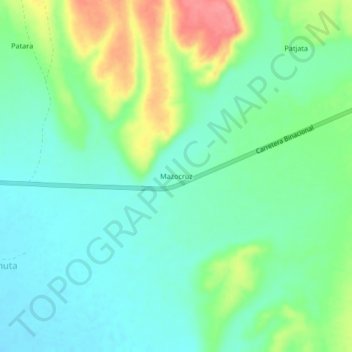
Name: Mazocruz topographic map, elevation, terrain.

Location: Mazocruz, Candarave, Tacna, Perú (-16.90236 -70.33745 -16.86236 -70.29745)

Average elevation: 4,489 m

Minimum elevation: 4,465 m

Maximum elevation: 4,542 m

Gear up for your next adventure:

🥾Trekking Boots - Durable boots for long-distance trekking
🥾Trail Hiking Shoes - Durable shoes designed for rugged trails
🪜Heavy Duty Carabiners - Multi-use clips for securing gear to your backpack
🥾Mountaineering Boots - Supportive boots for climbing and high-altitude hiking
Backpacking Tent - Lightweight tent for long-distance hiking trips

As an Amazon Associate, this site earns from qualifying purchases at no extra cost to you.