Geolocate

Eibiswald topographic map

Click on the map to display elevation.

About this map

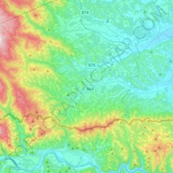
Name: Eibiswald topographic map, elevation, terrain.

Location: Eibiswald, Bezirk Deutschlandsberg, Styria, 8552, Austria (46.63938 15.02237 46.74569 15.32526)

Average elevation: 556 m

Minimum elevation: 293 m

Maximum elevation: 1,404 m

Other topographic maps

Click on a map to view its topography, its elevation and its terrain.

Gear up for your next adventure:

💧Filtered Water Bottle - Safe drinking water on the go
🔨Vehicle Emergency Tool - Safety tool for remote road trips to trailheads
🥾Hiking Gaiters - Protect legs and shoes from mud, snow, and debris
🛶Kayak Accessories - Essential gear for safe and fun kayaking adventures
Backpacking Tent - Lightweight tent for long-distance hiking trips

As an Amazon Associate, this site earns from qualifying purchases at no extra cost to you.