Geolocate

Wajak topographic map

Click on the map to display elevation.

About this map

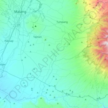
Name: Wajak topographic map, elevation, terrain.

Location: Wajak, Kabupaten Malang, East Java, Java, 65173, Indonesia (-8.26316 112.57534 -7.94316 112.89534)

Average elevation: 660 m

Minimum elevation: 293 m

Maximum elevation: 2,824 m

Gear up for your next adventure:

🛶Waterproof Dry Bags - Keep electronics and clothes dry during river crossings
🧥Waterproof Pants - Keep dry during rainy hiking conditions
💧Reusable Water Bottle - Durable water bottles for hydration on trails
🪑Ultralight Camping Stool - Compact seating for rest stops during long hikes
🧢Sun Protection Cap - Breathable cap to protect from sun exposure

As an Amazon Associate, this site earns from qualifying purchases at no extra cost to you.