Geolocate

Silvaplana topographic map

Click on the map to display elevation.

About this map

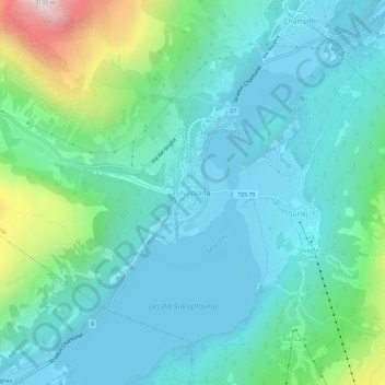
Name: Silvaplana topographic map, elevation, terrain.

Location: Silvaplana, Maloja, Grisons, 7513, Switzerland (46.43993 9.77592 46.47993 9.81592)

Average elevation: 2,027 m

Minimum elevation: 1,786 m

Maximum elevation: 3,006 m

Gear up for your next adventure:

🪑Ultralight Camping Stool - Compact seating for rest stops during long hikes
🧴Outdoor Sunscreen - High SPF protection for high-altitude UV exposure
🦌Outdoor Trail Camera - Monitor wildlife activity near your favorite spots
🧼Biodegradable Camp Soap - Environmentally friendly cleaning for gear and body
🌬️Windproof Camp Stove - Efficient cooking even on exposed mountain peaks

As an Amazon Associate, this site earns from qualifying purchases at no extra cost to you.