Geolocate

Corpus Christi topographic map

Click on the map to display elevation.

About this map

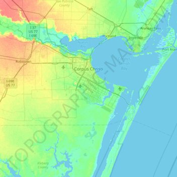
Name: Corpus Christi topographic map, elevation, terrain.

Location: Corpus Christi, Nueces County, Texas, United States (27.48357 -97.68274 27.89964 -96.96111)

Average elevation: 8 m

Minimum elevation: -3 m

Maximum elevation: 38 m

Other topographic maps

Click on a map to view its topography, its elevation and its terrain.

Gear up for your next adventure:

📷Outdoor Action Camera - Capture high-elevation views and rugged adventures
🛰️Satellite Messenger - Emergency communication for areas with no cell service
🧥Softshell Hiking Jacket - The perfect balance of wind protection and breathability
🥾Hiking Boots - Sturdy boots providing ankle support and traction on rugged trails
🛌Down Sleeping Bag - Superior warmth-to-weight ratio for cold nights

As an Amazon Associate, this site earns from qualifying purchases at no extra cost to you.