Geolocate

Pilon topographic map

Click on the map to display elevation.

About this map

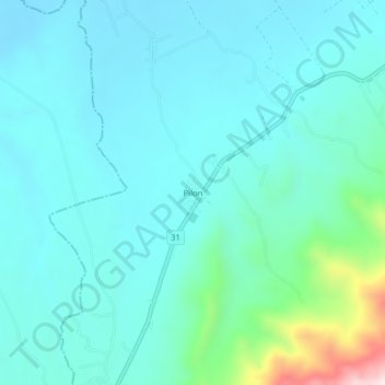
Name: Pilon topographic map, elevation, terrain.

Location: Pilon, Caloto, Norte, Cauca, RAP Pacífico, Colombia (3.07405 -76.36365 3.11405 -76.32365)

Average elevation: 1,089 m

Minimum elevation: 1,002 m

Maximum elevation: 1,561 m

Gear up for your next adventure:

🌡️Emergency Mylar Blankets - Compact thermal protection for unexpected nights outdoors
🥾Waterproof Hiking Shoes - Durable shoes for wet and rugged trails
🥾Lightweight Hiking Boots - Boots for comfort and mobility on long hikes
📷Outdoor Action Camera - Capture high-elevation views and rugged adventures
👟Trail Running Shoes - Agile footwear for fast-paced topographic exploration

As an Amazon Associate, this site earns from qualifying purchases at no extra cost to you.