Geolocate

San Juan topographic map

Click on the map to display elevation.

About this map

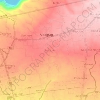
Name: San Juan topographic map, elevation, terrain.

Location: San Juan, Alitagtag, Batangas, Calabarzon, 4205, Philippines (13.83961 120.98738 13.87961 121.02738)

Average elevation: 192 m

Minimum elevation: 1 m

Maximum elevation: 252 m

Gear up for your next adventure:

🛁Quick-Dry Microfiber Towel - Space-saving towel that dries rapidly on the move
🧥Softshell Jacket - Windproof and breathable jacket for hiking
💧Hydration Pack - Hands-free hydration system for long hikes
🥾Mountain Hiking Boots - High-traction boots for rocky terrain
🧴Sunscreen SPF - Broad-spectrum sunscreen for outdoor activities

As an Amazon Associate, this site earns from qualifying purchases at no extra cost to you.