Geolocate

Segovia topographic map

Click on the map to display elevation.

About this map

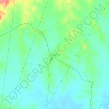
Name: Segovia topographic map, elevation, terrain.

Location: Segovia, Sincelejo, Montes de María, Sucre, Colombia (9.21621 -75.39223 9.25621 -75.35223)

Average elevation: 153 m

Minimum elevation: 127 m

Maximum elevation: 227 m

Other topographic maps

Click on a map to view its topography, its elevation and its terrain.

Parque Santander

Colombia > Sucre > Sincelejo > Sincelejo

Average elevation: 203 m

Gear up for your next adventure:

🔦LED Headtorch - Bright and durable light for night activities
🧢Hiking Hat - Sun-protective and breathable hats for long treks
🔭Compact Monocular - One-handed bird watching and trail spotting
🧶550 Survival Paracord - Versatile utility cord for emergency repairs and rigging
👟Trail Running Shoes - Agile footwear for fast-paced topographic exploration

As an Amazon Associate, this site earns from qualifying purchases at no extra cost to you.