
Thank you for supporting this site ❤️
Make a donation
Make a donation
Gear up for your next adventure:
As an Amazon Associate, this site earns from qualifying purchases at no extra cost to you.
Heisterberg topographic map
Click on the map to display elevation.
Thank you for supporting this site ❤️
Make a donation
Make a donation
Gear up for your next adventure:
As an Amazon Associate, this site earns from qualifying purchases at no extra cost to you.
About this map
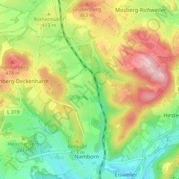
Name: Heisterberg topographic map, elevation, terrain.
Average elevation: 398 m
Minimum elevation: 313 m
Maximum elevation: 508 m
Thank you for supporting this site ❤️
Make a donation
Make a donation
Gear up for your next adventure:
As an Amazon Associate, this site earns from qualifying purchases at no extra cost to you.
Other topographic maps
Click on a map to view its topography, its elevation and its terrain.
Pinsweiler
Deutschland > Saarland > Landkreis St. Wendel > Namborn
Pinsweiler liegt auf einer Höhe von 335 m über N.N.
Average elevation: 378 m